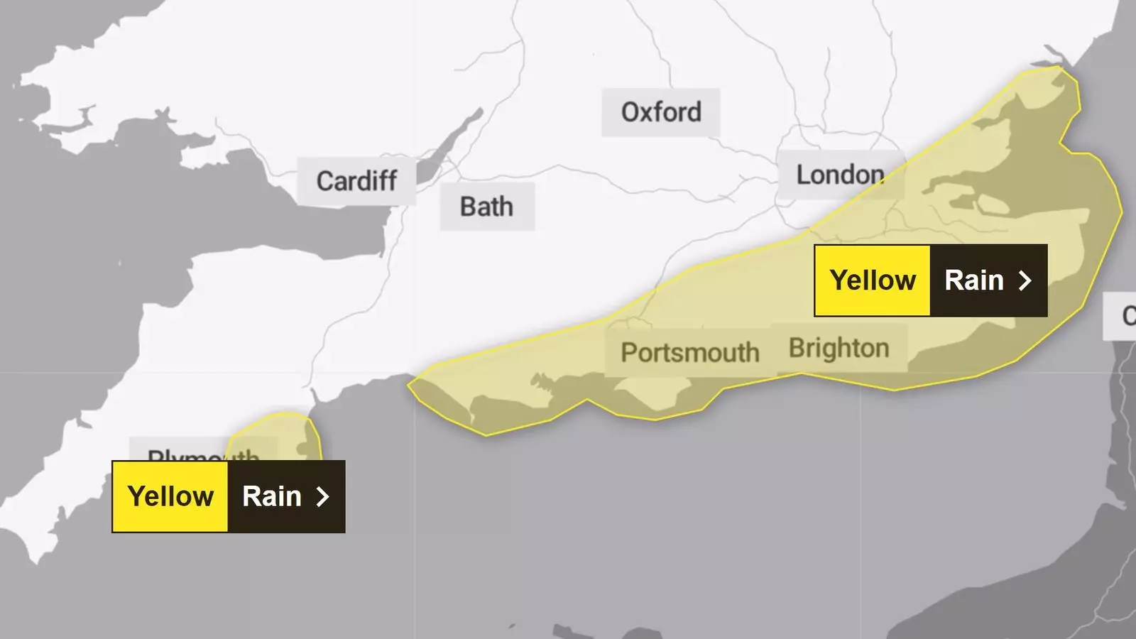
As the UK braces for yet another bout of severe weather, the third named storm of the season, Storm Conall, threatens to unleash significant rainfall across southern England tonight. Experts predict that parts of the region could see as much as 50mm (about two inches) of rain, a disconcerting forecast that follows the recent devastation caused by Storm Bert. This article delves into the anticipated impacts of Storm Conall, the ongoing repercussions from previous storms, and the broader implications for weather patterns in the UK.
Storm Conall, designated by the Dutch weather service KNMI, is characterized by an area of low pressure advancing toward the south of England. The storm is expected to produce intense rainfall, with the Met Office issuing a yellow rain warning for areas including Kent, Sussex, and the Isle of Wight. This advisory indicates the possibility of hazardous conditions, prompting residents to prepare for potential disruptions.
Rainfall estimates suggest that southern counties could expect between 15mm to 20mm (0.6 to 0.8 inches) of rain, with localized areas potentially receiving up to 50mm. This prediction raises concerns among meteorologists and government agencies alike, highlighting the risk of flooding and travel disruptions. The urgency of these warnings is magnified by the recent devastation caused by Storm Bert, which left many communities scrambling to recover from torrential rains and winds exceeding 80mph.
The aftermath of Storm Bert is still being felt across many areas of the UK, where roads were transformed into rivers and countless homes were inundated. As communities continue with recovery efforts, the looming threat of Storm Conall brings with it a sense of frustration and anxiety. Many families remain unsettled, still grappling with the damage inflicted by the previous storm while preparing for yet another potential disaster.
According to the Met Office, the risk of flooding this week remains high, particularly in Northamptonshire, where significant impacts are anticipated. River levels in regions like the River Severn are under scrutiny, as experts monitor for “minor” flooding. Meanwhile, flood alerts and warnings are still active in various parts of the country, indicating that the threat of flooding is not merely hypothetical but a present reality that communities must confront.
Understanding storm patterns is critical for effective communication and preparedness. The practice of naming storms—initiated collaboratively by the KNMI, the Met Office, and Ireland’s Met Eireann—serves an essential purpose: it streamlines communication during severe weather events, enabling timely responses from emergency services and communities alike.
The storm naming tradition, which began in 2015, typically runs from early September to late August of the following year, aligning with the onset of autumn. By providing distinct names, meteorologists aim to increase public awareness and understanding of storms, ensuring that everyone remains alert and prepared for incoming weather threats.
As the UK faces the brunt of Storm Conall, it becomes increasingly critical for residents and local authorities to remain vigilant. The anticipated heavy rainfall brings with it a heightened risk of flooding and disruption, laying bare the vulnerabilities that many communities experience during adverse weather conditions.
With the specter of climate change looming ever larger, characterizing storm patterns and drafting proactive measures for disaster preparedness will only grow in importance. Weather agencies must continue to monitor these developments closely, while individuals should remain informed and ready to respond effectively to the challenges that lie ahead. As Storm Conall approaches, the imperative remains clear: preparation is the key to resilience against the persistent threat of severe weather.


Leave a Reply